Industry Process Experience
Import and manage geoscience data in a cohesive environment. Federate and apply semantics to enrich the data used throughout downstream processes. Control permissions and access to data and visualize it in a single environment that can be shared to the right stakeholders at the right time.
Effectively and efficiency plan campaigns to collect additional data to enrich the understanding of the Earth’s properties and automate the collection and management of this understanding for rapid analyses.
Roles
Collaborative Designer for Surpac (UDG-OC)
Collaborate effectively by connecting SURPAC desktop application and data to the 3DEXPERIENCE platform

Benefits:
- Collaborate effectively by connecting SURPAC desktop application and data to the 3DEXPERIENCE platform.
- Accelerate Time to Value through immersive Product Lifecycle Management capabilities inside SURPAC.
- Improve Productivity by eliminating non-value-added work producing, copying, translating Surpac data with all 3DEXPERIENCE apps.
Highlights:
- Integration of Surpac SDM data within Unified Product Structure.
- Native use of Surpac SDM data in 3DDashboard Widgets.
- Immersive access to 3DEXPERIENCE Widgets in Surpac.
- Formalized collaboration using Tasks, Change Actions.
- Surpac SDM Derived Format support in 3DEXPERIENCE Authoring Apps.
Conversion Data Integrator for OMF (MOC-OC)
Make geology & mine design team contributions available across the company for global business processes
Benefits:
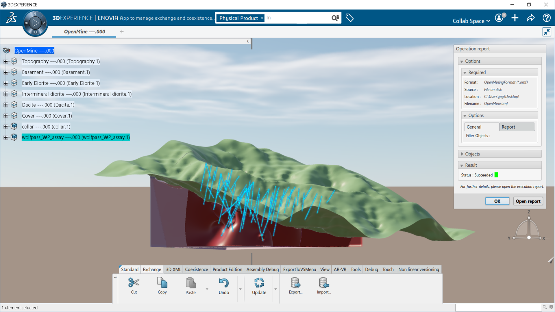
- Reuse, share, and migrate Open Mining Format data from Geology & Mine Planning applications for use with the 3DEXPERIENCE platform.
- Make partner contributions available across the company for global business processes.
- Hold design reviews for better product quality with imported OMF data.
Highlights:
- Import Open Mining Format data into the 3DEXPERIENCE platform to hold design reviews for better project quality.
- Use geological data as context for 3DEXPERIENCE engineering applications.
- Make geology & mine design team contributions available across the company for global business processes.
- Export Open Mining Format data from the 3DEXPERIENCE platform for use in 3rd party software applications.
- Open Mining Format support in Exchange Spaces Polyhedral surfaces conversion from/to CATIA Mesh.
Conversion Data Integrator for Surpac (FOG-OC)
Collaborate with anyone using SDM or DTM formats from Geology & Mine Planning software
Benefits:
- Collaborate with anyone using SDM or DTM formats from Geology & Mine Planning software.
- Make partner contributions available across the company for global business processes.
- Hold design reviews for better product quality with imported SDM or DTM data.
Highlights:
- Import DTM and SDM format data into the 3DEXPERIENCE platform to hold design reviews for better project quality.
- Use Geological DTM or SDM data when designing in context with 3DEXPERIENCE applications.
- Make Geology contributions available across the company for global business processes.
- Export DTM and SDM format data from the 3DEXPERIENCE platform for Earthworks in Surpac.
- Polyhedral surfaces conversion from/to CATIA Mesh.
Earth Engineering Coordinator (ETC-OC)
Manage structured and unstructured geoscience information in the 3DEXPERIENCE platform
Benefits:
- Collaborate with anyone using SDM or DTM formats from Geology & Mine Planning software.
- Make partner contributions available across the company for global business processes.
- Hold design reviews for better product quality with imported SDM or DTM data.
Highlights:
- Import DTM and SDM format data into the 3DEXPERIENCE platform to hold design reviews for better project quality.
- Use Geological DTM or SDM data when designing in context with 3DEXPERIENCE applications.
- Make Geology contributions available across the company for global business processes.
- Export DTM and SDM format data from the 3DEXPERIENCE platform for Earthworks in Surpac.
- Polyhedral surfaces conversion from/to CATIA Mesh.
Geoscience Referential Manager (GRM-OC)
Ingest geoscience data for use on the 3DEXPERIENCE platform
Benefits:
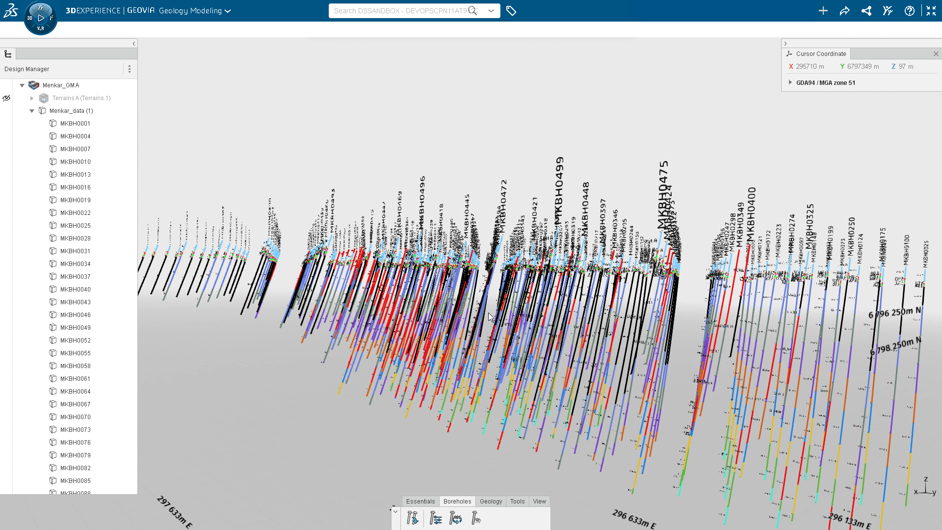
- Administrate and manage geoscience data with external data sources using a dedicated web app including, data semantics and access rights.
- Define geoscience data characteristics for the 3DEXPERIENCE platform including positioning and visual representation settings.
- Provide a constant monitoring of geoscience data’s lifecycle to maintain data integrity and auditability.
- Interpret geoscience data to allow strong & confident understanding of the underground.
Highlights:
- Ingest geoscience data for use on the 3DEXPERIENCE platform.
- Define attribute value display settings.
- Manage attribute access rights.
- Create new attribute interpretations.
- Manage status of the geoscience dataset.
- Interpret borehole in regards AEC data.

