Experience the Power of GEOVIA on the 3DEXPERIENCE platform
GEOVIA on the 3DEXPERIENCE platform offers mining companies, engineers, geoscientists, and urban planners a comprehensive, real-time view of their work activity and ecosystem, and seamlessly connects individuals, ideas, data, and solutions within a single collaborative and interactive environment.
3DEXPERIENCE GEOVIA empowers you to assess a project’s value before breaking ground, enabling you to design and optimize it — well before construction begins. And it provides you with the tools you need to analyze and embed the sustainability of your operation, centralize and manage all your data, and work with colleagues from anywhere in the world.
The Virtual Twin Advantage
3DEXPERIENCE GEOVIA provides the tools you need to create virtual twins of the earth’s surface, subsurface, and infrastructure through which you can run nearly limitless scenarios to visualize and analyze your assets and processes, test your ideas, and explore the impact of your decisions.
The result: Well-thought-out, well-founded decisions that both improve operational efficiency and optimize resource use.

3DEXPERIENCE GEOVIA software products are packaged as Roles to get you up to speed faster and work more efficiently with all needed applications available at your fingertips. Select a package that corresponds to your role in an organization.
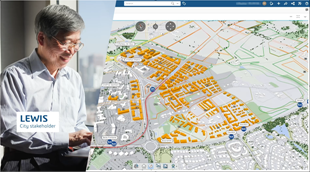
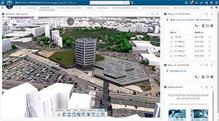
City Contributor
Exceptional geospatial context
and collaboration through
semantic-rich virtual twins.

City Referential Manager
Create and maintain best-in-class territorial virtual twins, enabling sustainable urban transformations and infrastructure projects.
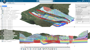
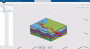
Earth Engineering Coordinator
Consolidate and federate geoscience and
engineering information for seamless
downstream consumption.
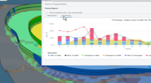
Pit Optimizer
Enhance overall value and efficiency with comprehensive planning strategies from optimization to scheduling.
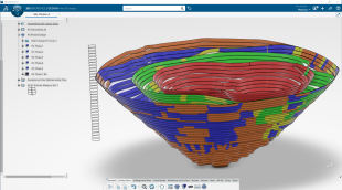
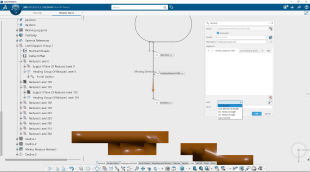
Underground Mine Designer
Generate and evaluate multiple
development designs through
an automated parametric process.
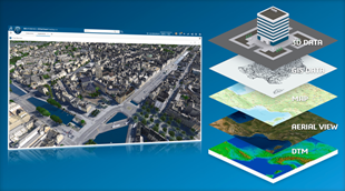
City Data Engineer
Create, transform and prepare
geospatial data for insightful
data visualization in context.

City Viewer
Foster holistic geospatial awareness
through territorial virtual
twin experiences.
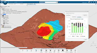
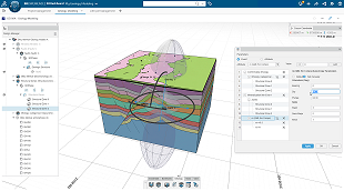
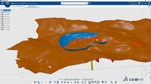
Geology Modeler
Accelerate the creation of 3D geological models of the subsurface environment with the ability to rapidly test multiple hypotheses.
Strategic Mine Planner
Comprehensively evaluate strategic mining plans from development to closure, implementing robust plans prioritizing economic value.
City Planner for Education
With the virtual twin of their preferred city, urban planning students can explore options to shape a more resilient and sustainable living environment.
Conversion Data for OMF
Convert Open Mining Format data to unlock
the value of data-driven collaborative and innovative business process.
Geoscience Referential Manager
Define & manage the geoscience
data referential from geoscientists, consultants and contractors.
Surface Mine Designer
Generate and evaluate multiple pits, ramp and waste storage facility design through an automated parametric process.